This walk goes along the disused railway line from towards Southwell before heading across Norwood Park, entering the Westhorpe of Southwell and going through Halam. We then return to the start via Edingley and across fields.
Distance: 7 miles
Start: Kirklington Station car park. You can extend the walk (by about three miles) if starting from Farnsfield by walking along the railway track to the car park as described in walk. Finish by returning the same way or by walking back from Edingley across the fields using the route in Walk 3. The car park is situated by the old Kirklington station. The station is rather in the middle of nowhere lying nearly half a mile to the north of Edingley and south of Kirklington off a quiet country road. There is usually plenty of room in the car park and there is also a picnic site next to it.

Southwell Trail at Kirkington station

Winter on the Southwell Trail
Start the walk by leaving the car park eastwards along the main track by which you enter the car park from the road. The track becomes a road for a very short section by the house. As you reach the junction with track that goes up a slope out of the car park we carry straight on the old railway track under a large brick bridge. The track is a good one for walking on and is now only muddy in short patches and that is only rarely. The track is tree-lined and pleasant but is at the bottom of an embankment on each side so the views are very restricted. Carry straight on for the next mile and a half. At first you are under the embankment but after 400 yards you pass under another brick bridge and soon after that the sides of the path that have loomed above you start to decrease in height.
Before long you emerge from the embankment area altogether. However, the track is still contained by trees and hedges of hawthorn and blackthorn on either side of you. This restricts the views somewhat although you now can see through to the fields next to the track. Occasionally you will come across crossing places where tractors can pass between fields on different sides of the track. These give a better opportunity to have a look at what lies beyond the confines of the track. In winter these are often good places to see fieldfares and redwings. At all times of the year you may hear and see buzzards.

Maythorne
After a mile and a half on the track if you look to the left you will see the tall mill building of Maythorne. Just before you reach the road you come to a metal barrier. You emerge quite suddenly at the road. Although it is a quiet road you should be ready for this in case of traffic. The railway track continues straight ahead on the other side of the road, going all the way into Southwell. The road itself takes you into Maythorne if you turn left (see Walk 6 for a way back from Maythorne to the railway track near Farnsfield). However, on this walk we turn right along the road. After 80 yards the road turns right and then very soon left. After another 100 yards you come to the main road into Southwell. This can be quite busy so take care crossing and then turn right on the far side where there is a verge and then a footway.
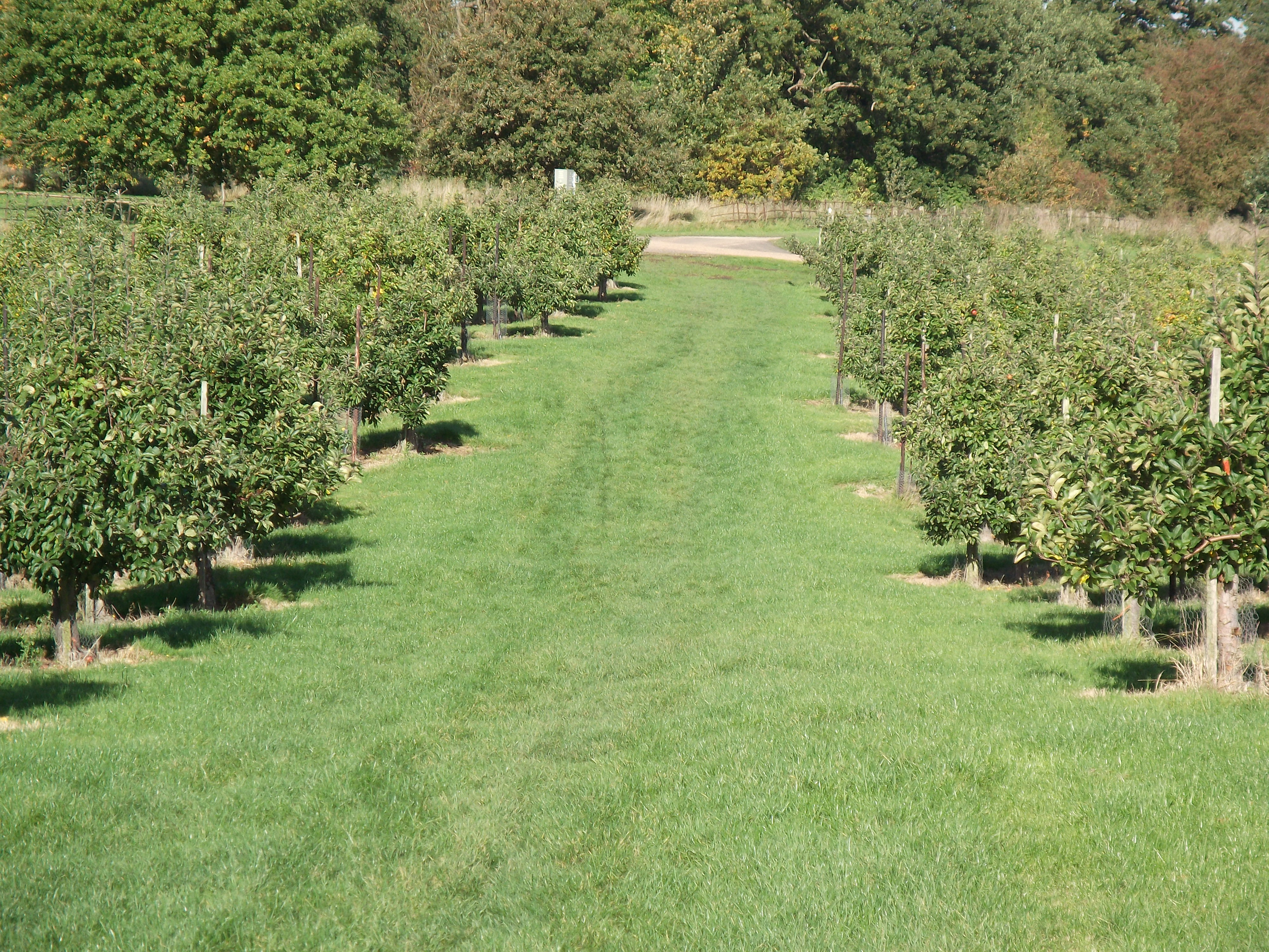
After 100 yards you reach the entrance to Norwood Park. Norwood Park has been much developed in recent years so that it now features a golf course and associated buildings. It is still a nice walk however. Turn into the entrance to Norwood Park and follow the path on the right hand side of the metal fence which runs alongside the drive for cars. You are now walking between the metal fence and a practice golf hole but fortunately there is a high, mesh fence protecting you from any stray golf balls. After 200 yards cross the road bearing right to the car park and continue straight on. Carry on ahead under the trees ignoring all further road turnings for another 200 yards where you emerge from the trees and see the house on your right and golf course to the left. At a crossroads look just ahead of you to your left and you will see a footpath sign and rather obsolete stile. Follow the sign and go round the stile along a wide avenue between apple trees. At first the path goes slightly downhill before climbing again.
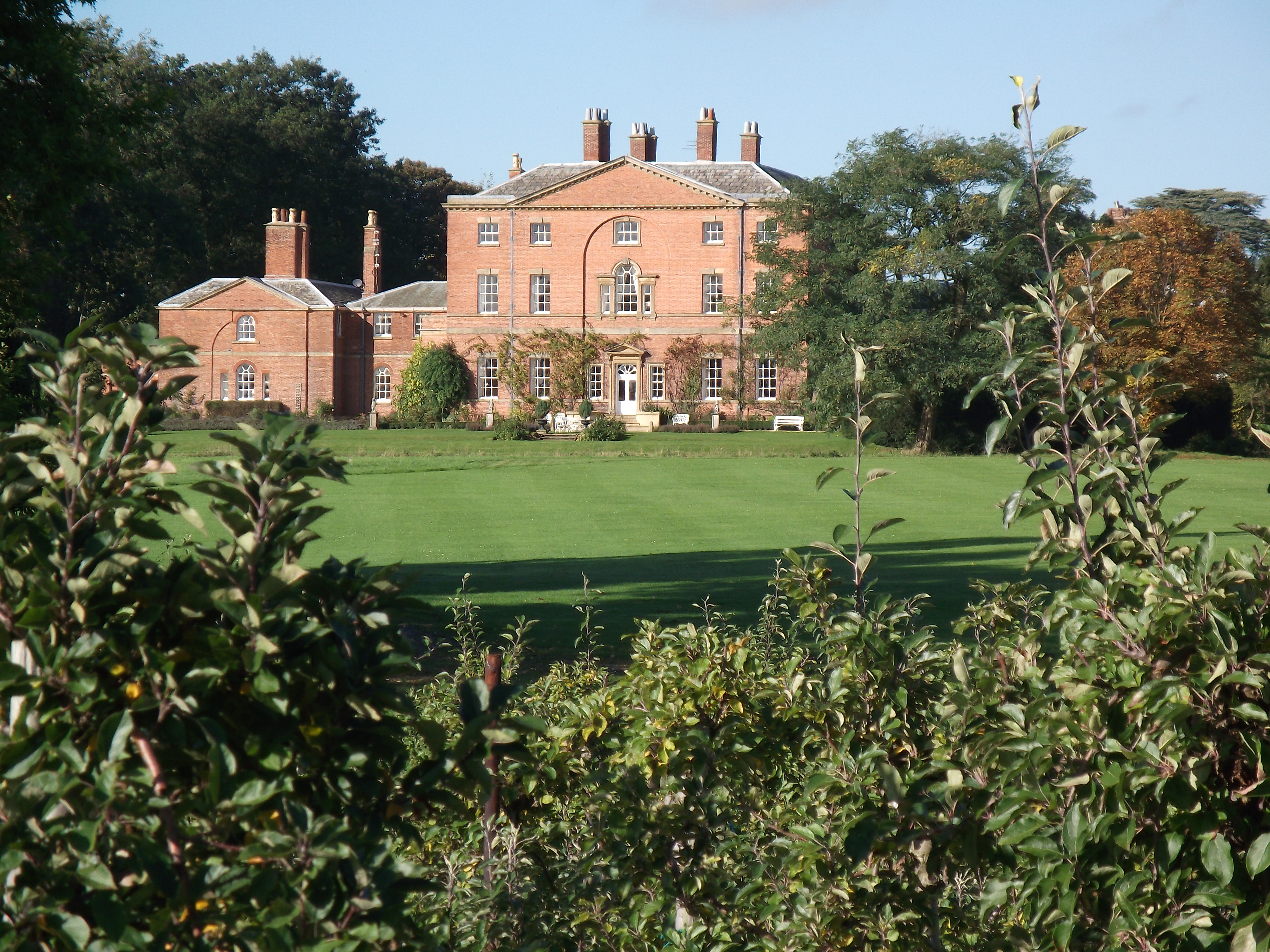
Norwood Hall
Norwood Park
At the top of this rise you have good views to the right of Norwood Hall and behind you to the left of the golf course. Ahead of you are the massed ranks of polytunnels used for cultivating fruit. Depending on the time of year the polytunnels will either be skeletons with only the frames showing or a series of long plastic tubes. Carry on ahead between them going downhill again. Shortly you reach the end of the tunnels and come to a field. Follow the edge of the field straight on down the hill with a treelined hedge on your left. At the bottom you go through a narrow gap in a thick hedge and emerge on the pavement next to the main road from Halam to Southwell. Take care crossing the road as it can be busy and having done so go straight ahead over a ditch into a large field. The path goes straight on up the hill through the field and is usually well- defined. At the top of the field keep just to the right of the row of houses as you come to the Oxton to Southwell road. At this point you can turn right along the road to cut out the next little section but the road can be busy and although there is a grass verge I prefer the quieter detour described here.
Cross this road and almost straight ahead on the other side you will see a narrow footpath going between the houses. Go down this footpath for 200 yards until you reach the road at the bottom. This is a quiet, pleasant road in the Westhorpe of Southwell. Turn right for 300 yards and at the end of the road turn right again going quite steeply up a narrow hedge-lined road. After 200 yards you are back at the Oxton road at a crossroads. Cross the road and go straight along the road opposite (Saversick Lane). After 200 yards you come to a house on the left with a wide tree-lined driveway.
Turn down the driveway but move over to the left to follow the fence on the grass next to the drive. After 100 yards you pass the house which is to the right of you. Pass a bit of wooden fencing and then keep straight on by the hedge on the left until you reach the corner of the field. Go through the gap in the corner and enter another field containing fruit in polytunnels. Keep going straight on following a path which passes the ends of the tunnels. This can be a little muddy in small areas but you can get around those patches. After 200 yards you reach the end of the polytunnels. Go straight on along a narrow path between trees next to hedge which in twenty yards takes you to the top of a steep grassy field. The view from here is excellent with the steepness of the field ahead seeming to accentuate the height of the hill beyond. If you wish you can go straight ahead into the field and down the hill where there are paths at the bottom which take you into Halam. This field often has cows in it and the last time I was there they were blocking the way into the field. This meant that I took a different, and in a way more interesting, route down to Halam.

Looking West to Halam and our route beyond.
To take this route don’t enter the field. Instead turn right along a narrow path between the hedge on your left and trees on your right. This soon starts descending and turns to the left in a small wood where the slope is steeper. At the bottom of this wood you reach the entrance to a grassy field. Head diagonally across this field downhill aiming just to the right of the church. You leave the field and enter the churchyard. Go through the churchyard on a firm path going straight on down to the main street in Halam. Cross the road and turn left along the pavement for two hundred yards.
As you get towards the sharp left bend in the road at the end of the street (you are still in the village) look to the right for a footpath going along a drive at Manor Farm. Take this path and head towards tennis courts. Pass to the right of them over some grass. You cross a footbridge over a stream then turn left along a narrow path for thirty yards before entering a grassy field at the bottom of a hill. Turn right and go up the hill next to a hedge on your right. After 200 yards leave the field next to a house (Machin’s Farm). Carry on straight up the hill passing the house and then enter a narrow tree-covered path for 100 yards. Emerge from this small copse through a kissing gate into a large field. You now walk along the ridge with the hedge immediately on your left. The views are very good as you are now high up relative to the surrounding countryside. As you get further along the ridge you can look behind you to the east and often see plumes of smoke from Newark. Walk straight along the ridge for 400 yards until you reach the road at Newhall Lane.
Turn right along the lane passing the entrance to the caravan site at Newhall Farm. Then go downhill and then uphill again along the very straight lane. Pass a few more dwellings as you descend to the junction of Newhall Lane and Little Lane. Turn left onto Little Lane but after only fifty yards down the hill take a slightly rougher road to the right. After another fifty yards look for a footpath on the left going downhill diagonally across a field. Take this path, which is usually well-defined, and go into another smaller field. Follow the path across and leave this field, going onto a short pebbly drive next to a house. Scrunch your way the short distance to the road. You are now in Edingley.
Cross the road just to the left of the junction opposite where another road meets the main one. Turn left along the pavement for twenty yards where you come to the corner of a large field, most recently containing small saplings. The field is slightly lower than the pavement. Go down into the field and walk along the edge of it away from the road alongside the dyke containing Edingley Beck. After 400 yards you reach the end of this field. Go over the stile into a much smaller field and carry on in the same direction across this and another two small fields. You come to a farm road. Cross this into the field opposite and carry straight on by the dyke through this large field and three small ones. The path continues almost straight all the way until you climb the steps up the embankment taking you back onto the railway track at Kirklington station where you started.

My partner and I did this walk yesterday. Your instructions were great! We’ve been on walks around Nottinghamshire with just an OS map before and come across very neglected and unwalkable routes, so it’s nice to go on a recommended route and not have to worry about over grown paths etc. Thank you for sharing this!
Thanks for your feedback. It’s good to know that my instructions work. I’m glad that you enjoyed the walk. With the wet conditions at the moment many paths aren’t too good but I think that most of this walk should be OK.
How long does this take and what is the difficulty?
The walk is seven miles in total so I would say if you are taking it a normal sort of pace it would take nearly three hours. As with most of these walks there are no major climbs to deal with. There are a couple of short, gentle climbs on the way to Southwell and a short but sharp climb on the road on the way out of Southwell. The main climb on the walk is the one on the way out of Halam. It isn’t particularly steep but will take three or four minutes to reach the top. There is one more small hill on the road going towards Edingley. The walk is flat from Edingley and along the railway track. Of course there are also a few downhill sections to compliment the uphill and the only one to take a little care on is going through the wood to Halam which may be a little muddy and slippery at the moment. The paths on this walk should be in pretty reasonable shape even at this time of year. Much of it is on quiet roads and good tracks. The only other path that is likely to be muddy is the one going across the field into Southwell after you leave Norwood Park. Hope this answers your questions.